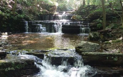
Cool Spring Waterfall by Sean Lloyd | Aug 16, 2018 Distance: 3 Miles Route Route Type: Out & Back Difficulty: Easy Follow a paved path through the old golf course along the Shenandoah River, then off-road on a flat footpath that winds through a grove of paw-paw trees, across a stream over stepping stones, and then a few more steps until you reach a beautiful waterfall. The land you’re walking through was the site of the Battle of Cool Spring in 1864, much later became a golf course, and recently Shenandoah University reclaimed the property and maintains it as an outdoor classroom for both its community and the general public. Beyond the waterfall is the River Ridge Trail, which connects into a network of trails, including the Appalachian Trail (just north of Raven Rocks). Click here for parking info and a map. 
Bear's Den Overlook
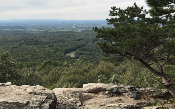
by Berryville/Clarke Cnty AT Community | July 2019 Distance: .5 miles+ Route Type: Out & Back/Circuit Difficulty: Easy Whether you start at the A.T. trailhead near VA-7 or from the parking lot at Bears Den Hostel, the goal of this hike is Bears Den Overlook, a collection of rocks and boulders that offer an outstanding view of the Northern Shenandoah Valley and the Allegheny Mountains in West Virginia more than 40 miles away. The rocks, which are great for scrambling, served as a signal station during the Civil War. Exploring the rocks, you’ll find graffiti carved by soldiers. Take time to wander the side trails around the Bears Den Hostel, a magnificent, large stone home built in 1933 by a prominent Washington, D.C., couple who summered on the mountaintop. Since the 1980s, Bears Den has served as a hostel for A.T. hikers and others. Getting There: From Berryville, take VA-7 (Harry Byrd Highway) east, cross the Shenandoah River, climb the mountain, and turn right onto Rt. 601 (Blue Ridge Mountain Road). Immediately turn right into large commuter parking lot, and look for blue-blazed side A.T. trail at the back of the lot. Or, drive for one-half mile on Route 601 to the Bears Den driveway on right, and follow the gravel road to a parking lot. Follow easy-graded path to from that point. |
Raven Rocks Hollow Run
by Sean Lloyd | Jun 25, 2018 Distance: 4 Miles Route Type: Out & Back Difficulty: Moderate This out-and-back hike takes you up and away from Rte 7 for about 1.5 miles before a half-mile steep descent to Raven Rocks Hollow Run, the turnaround spot. You’ll find a nice shady place to hang out and enjoy a snack before returning south to your car. If you’re thirsty, there’s a spring about 100 yards down a blue blaze trail where you can collect water (filtration recommended). Hiking Upward has more great information. Their hike takes you all the way to the Raven Rocks cliff, which offers a beautiful view for only one more mile (round trip). Click here for parking info and a map. 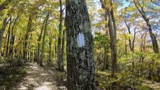
AT Section Hike:
Front Royal to Harper's Ferry by Ken Nail | Feb 7, 2019 Distance: 55 Miles Route Type: South to North Difficulty: Moderate After leaving Shenandoah National Park, the AT continues north along a series of low ridges, traversing the horse farms and exurban landscape of Northern Virginia and skirting the border of West Virginia until it crosses the Shenandoah River to arrive at Harpers Ferry, WV. By the time you reach Northern Virginia on the AT, the big mountains and high elevations are well behind you. In fact, the trail only twice grazes 2,000 feet in elevation as you descend to the low point of Harpers Ferry, a mere 300 feet or so above sea level. But don’t get the impression that the low elevations mean you’ll be sauntering along in the flatlands. You’ll find many climbs and descents along this section, and while they’re not generally very long, they can present a stiff challenge at times. After the more isolated sections of Virginia to the south, you’ll notice the proximity of population centers as well. You’ll cross several busy highways, and, depending on the season and time of the week, you’ll encounter your fair share of day hikers and weekenders as you traverse this section. For hike details and suggestions, read Ken's full article on The Trek. |
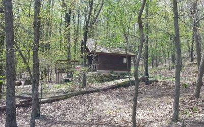
Keyes Gap to David Lesser Shelter by Sean Lloyd | Apr 20, 2018 Distance: 6 Miles Route Type: Out & Back Difficulty: Moderate A simple walk in the woods along the Appalachian Trail starting from the Keyes Gap parking lot turning around point at the David Lesser shelter – an excellent example of an Appalachian Trail shelter used by thru-hikers walking from Georgia to Maine. It’s the perfect midway point to relax and eat your lunch, complete with a picnic table and swing. Just downhill from the shelter is a stream where you can collect water (filtration recommended). From Wikipedia: Keyes Gap is a wind gap in the Blue Ridge on the border of Loudoun County, VA, and Jefferson County, WV. VA/WV Rte 9 traverse the gap. Originally known as Vestal’s Gap, the 906-foot gap is one of the lowest crossings of the Blue Ridge in Virginia. During colonial times, the main road between Alexandria and Winchester ran through the gap, and Gen. Edward Braddock’s army under George Washington crossed the gap en route to Fort Duquesne during the French and Indian War. Click here for parking info and a map. 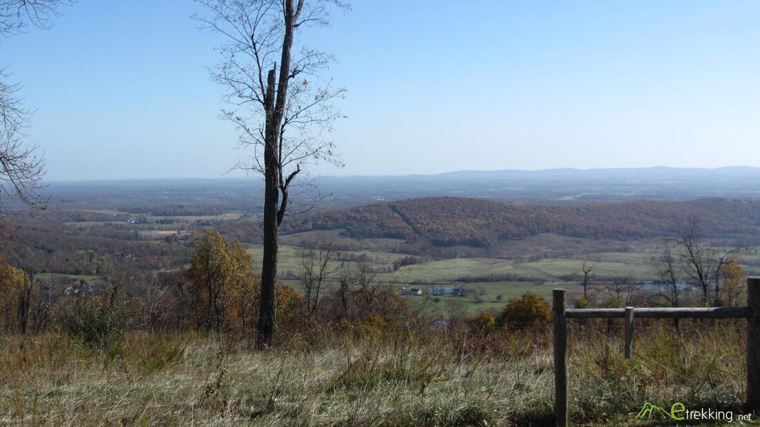
Liberty Hill-Sky Meadows
by Berryville/Clarke Cnty AT Community | July 2019 Distance: 7 miles Route Type: Circuit Difficulty: Moderate This “balloon” loop takes you through a forest and open meadows to an interesting view to the east. If you’re hiking in spring, you’ll find abundant wildflowers. Begin at the trailhead off Liberty Hill Lane, and climb up hill along the A.T. After a mile, find a well-marked intersection. Follow the purple-blazed Old Trail through thick forest. This was the old A.T. until land was purchased on the ridge top. After 3 miles, rejoin the A.T. Turn left and hike through open meadows and forest for a mile until you come to the Ambassador Whitehouse Trail. Follow this trail through open meadow to the Paris Overlook, where you can look east toward Bull Run Mountain and see tall buildings near Dulles International Airport through gaps in the mountain. Return on the Ambassador Whitehouse Trail to the A.T., completing the loop and descent back to the trailhead. Getting There: From Berryville, take US-340 (Lord Fairfax Highway) south, turning left onto US- 50 (John Mosby Highway). Take US-50 east across the Shenandoah River. Near the crest of the mountain at Ashby Gap, turn right onto Liberty Hill Lane and find parking right at this turn. |
